notes.husk.org/likes
images.
tagged aerial view.
page 7 of 13 with 305 images.
aerial view
architecture
geometric pattern
glass structure
top down view
minimalism
symmetry
urban design
bird's eye view
shadows
Daily Overview
2 images
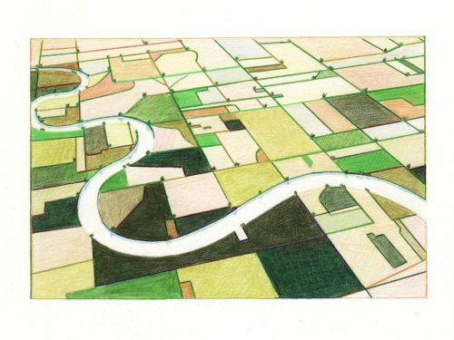
aerial view
landscape illustration
winding river
farmland
colored pencil drawing
agricultural landscape
nature art
green fields
river valley
pastoral scene
things magazine tumblr
aerial view
cityscape
river
bridge
train station
railway tracks
urban landscape
drone photography
infrastructure
waterway
Daily Overview
aerial view
black and white
car arrangement
klm logo
aviation photography
monochrome
airplane shape
creative composition
tarmac
airline branding
STML
7 images
aerial view
suburban neighborhood
residential area
planned community
urban planning
patterned streets
bird's eye view
housing development
concentric patterns
desert landscape
Advanced Methods for Geospatial Image Analysis
satellite imagery
aerial view
border
agriculture
landscape
farmland
topography
geography
land use
arid terrain
Advanced Methods for Geospatial Image Analysis
aerial view
satellite imagery
meandering river
salt flats
estuary
mudflats
abstract landscape
top-down view
river delta
earth tones
Advanced Methods for Geospatial Image Analysis
highway interchange
aerial view
satellite imagery
infrastructure
road junction
transportation
landscape
cloverleaf
top-down view
road network
Daily Overview
aerial view
aircraft storage
airplane boneyard
satellite imagery
aviation
desert landscape
aircraft graveyard
top-down view
pattern
planes
Daily Overview
space shuttle
nasa
earth from space
orbit
spacecraft
aerial view
earth landscape
clouds
satellite view
universe
zeppelin shadow
steam train
aerial view
black and white
vintage
farmland
locomotive
airship
monochrome
historical
Tecznts
2 images
aerial view
ruins
war
destruction
devastation
rubble
historical
monochrome
urban destruction
texture
Fresser.
agriculture
aerial view
plantation
pattern
farming
landscape
crops
nature
top down
greenery
Daily Overview
aerial view
salt flats
lithium mining
evaporation ponds
salt pans
salar
industrial landscape
brine extraction
desert landscape
geometric patterns
Eating at the trash bin of Ideology
airport
aviation
aerial view
runway
airplane
taxiway
top down
aircraft
infrastructure
aerodrome
Daily Overview
solar energy
renewable energy
concentrated solar power
desert landscape
aerial view
solar thermal plant
sustainability
clean energy
heliostats
solar farm
Notational
airport
airplane
aviation
aerial view
travel
transportation
aircraft
terminal
runway
top-down view
rachelbinx
open-pit mine
quarry
excavation
mining industry
aerial view
industrial landscape
resource extraction
geology
terraced walls
mining site
things magazine tumblr
aerial view
logistics
truck trailers
distribution center
transportation
freight
shipping
supply chain
cargo
depot
Daily Overview
aerial view
pink salt pans
geometric pattern
salt evaporation ponds
top-down perspective
abstract landscape
rectangular plots
pink water
salt production
aerial photography
Daily Overview
aerial view
archaeological site
ancient ruins
geometric patterns
drone photography
burnt landscape
top-down view
landscape patterns
post-fire landscape
man-made structures
Daily Overview
aerial view
railway yard
train tracks
infrastructure
logistics
transportation hub
satellite imagery
industrial landscape
railroad depot
transportation network
Daily Overview
satellite imagery
aerial view
coastal town
urban grid
waterfront
cityscape
top-down
harbor
infrastructure
coastline
Daily Overview
aerial view
landscape
salt flats
desert
mineral deposits
turquoise water
top-down photography
nature
geology
abstract landscape
Daily Overview